This page looks at old and new faces of Baie-D'Urfé and puts them side by side.
Note that this page has over 500 pictures and jumping up and down within this page will only work once most of those images are loaded. Wait a moment until you web browser has finished fetching the images.
You can read this page from top to bottom by scrolling down or you can click here to jump directly to one of the following sections:
The chapter about "Baie-d'Urfé's old houses built before 1850 or houses with a special history" has been moved to a separate page because the page was getting too big and causing problems for smaller devices.
Most of the houses in the eastern part of Baie-D'Urfé were only built around 1960 and 1970. The farm of architect Edward Maxwell used to be in this area. It was known as the Maxwelton Dairy Farm. Mr. Maxwell died in 1923 but the farm continued under professional management until 1939, when daughter Elizabeth (1908-1969) returned with her husband Christopher Montagu Yates (known as Monty, 1899-1984) and the twin boys, Ted and Henry, to live year-round in the big farmhouse.
Farmer Monty Yates was originally a stock broker at the Montreal stock exchange.
The Yates remained in the Maxwelton farmhouse for 30 years. In 1954 they started to sell the farmland for subdivisions but reserved 6 acres around their home and the outbuildings. Most of the herd was already sold off in 1953. A contractor bought the property in 1973 and added a 3 bedroom extension towards the back of the main farmhouse. The property changed ownership a few times in the 1980s with each owner selling another portion of the remaining land.
The main dairy barn and the silo do not exist anymore but some of the smaller barns, the house for the herdsman, cook and farm hands (#20 Picardy) as well as the main farmhouse (211 Oakridge) are all still there.
The main Maxwelton farmhouse was built in 1910 by Edward Maxwell. #20 Picardy was an older farm building that had been changed and modified by Edward Maxwell in 1910.
You can click on the images to see the full picture without the markings:
View towards the Maxwelton Farm, 1950. Today's Picardy park would be behind the trees on the right
View towards the former Maxwelton Farm, photo from google-earth in 2019
View from the Maxwelton Farm towards the water, 1950
View from the former Maxwelton Farm to the water, photo from google-earth in 2019
View from what would be today Gray Park towards the train tracks, 1950
View from Gray Park towards the train tracks and the highway, photo from google-earth in 2019
The house for the cook and the herdsman, photo late 1940s or early 1950s
The former cook and herdsman house in 2019, #20 Picardy
Only a decade later most of the fields had already disappeared and houses were built. The northern part of the Maxwelton Farm (near the highway) remained fields until the 1980s:
North-Eastern part of Baie-D’Urfé, including Maxwelton Farm, spring 1962, high resolution image, click on the image to see details
North-Eastern part of Baie-D’Urfé, including former Maxwelton Farm, 2019, images from Google Maps
Edward Maxwell (1867-1923) was a famous architect. He was born in Montreal and his grandfather had immigrated to Canada from Scotland in 1829. He bought in 1908 one hundred and sixty acres of farmland in Baie-D'Urfé where he built the Maxwelton, a large fieldstone house with associated farm buildings. As a "hobby farmer" he developed a herd of Jersey cattle.
Edward Maxwell at the age of 26, photo 1893, source: the McCord Museum collection II-100034
Edward Maxwell, 1867-12-31 to 1923-11-14, photo 1910, source: official town archives
Edward Maxwell, 1909, source: the McCord Museum collection II-176188
Edward Maxwell biography from the storied province of quebec, click to read
Christopher Montagu Yates and Elizabeth Joan Maxwell at the St-Andrew's Ball, the Gazette Dec. 2, 1968
Yates family grave at the Mount Royal Cemetery, Pine Hill section
Obituaries, Elizabeth Yates, the Gazette, Sep. 25, 1969
Yates & Co., The Gazette, May 14, 1930; the company merged in 1939 with other prominent Montreal stock brokers and became Mead, Yates & Osler; C. M. Yates stands for Christopher Montagu Yates
Maxwelton delivery van with Mr. Gordon Poole in 1930. Phone number 61 was the Maxwelton farmhouse in Baie-D’Urfé. It says "ST ANNE DE BELLEVUE" on the van and it could be that this is because of the phone number. Baie-D’Urfé was part of the switchboard in St-Anne.
Maxwelton about 1921, view from the south west, Photo: the McCord Museum collection VIEW-20650.A.0, photo copied in 1923
Maxwelton, view from the south west, Feb. 2021
Maxwelton in the 1940s, view from the south
Maxwelton Sep. 2019, view from the south-west
Maxwelton Sep. 2019, view from the west
Maxwelton July 2020, view from the west
Maxwelton July 2020, view from the south-west
Maxwelton, view from the west, winter, about 1950, source: Yates estate
Maxwelton March 2020, view from the west
Maxwelton original architectural drawing, source: http://cac.mcgill.ca/ Maxwells/images/184.2a.JPG
Maxwelton view from the east, photo: Nov. 2020, the modern extension is to the right, the original house ended at the chimney in the center of the photo.
Maxwelton view from the east, photo: Nov. 2020
Edward Maxwell used a very interesting design principle for both the Maxwelton and the Baie-D'Urfé Town Hall (see further down). The buildings have corners and pointed roof sections but the roof above the main entrance is round. This idea is taken from nature. Most of us understand it intuitively without being aware of it. The fruits on a fruit tree are round. Animals and humans should go to them and are indeed attracted to them. Other parts are pointed, sometimes even thorny. Think of flowers that have colorful round shapes to attract bees and butterflies while the green leaves are often pointed, sometimes with hard edges or even thorns. On the Maxwelton building the main entrance is not only round but the door has even a dark red color, like a ripe fruit or a flower. Visitors are intuitively guided towards it. It becomes a design that we like without really being fully aware of it and it is because of the design's consistency with the nature around us.
Some of the smaller barns and sheds of the Maxwelton farm are still standing today. All of them used to be painted in dark green. What is now a garage at 20 Picardy used to be the horse barn. The shed behind the horse barn is certainly an Edward Maxwell design with it's pointed roof opening that serves as a roof vent.
Google Street View picture of 20 Picardy taken in April 2009, left: employee building, right: horse barn
Horse barn with Edward Maxwell shed in the back, photo: Dec. 2020
Edward Maxwell shed, roof design, photo: Dec. 2020
The 4 original sheds/barns, photo: Dec. 2020
Below is a comparison of a 2019 aerial photo from google side by side with a photo from 1948. I have marked the buildings that are still standing. Google has better and sharper aerial photos but they are taken during the summer and the sheds below trees would not be visible.
Maxwelton aerial photo from 1948, the building marked in green was moved, source: Archives de la Ville de Montreal
Maxwelton aerial photo May 4, 2019, the building marked in green was moved, source: google
8 gal milk can with Maxwelton Farm Ste Anne de Bellevue engraved into it, source: Henry Yates
The 8 gal milk can is made from heavy tin coated steel and Maxwelton Farm Ste Anne de Bellevue. Stamped into it, source: Henry Yates
Wooden brush to clean the cows and a milk tester. The milk testers has a very fin mesh and this allows the farmer to see small lumps indicating problems with the milk, source: Henry Yates
Various heavy gauge tin buckets from the Maxwelton Farm. The one on the right attaches to a mechanical milking machine, photo: October 2023, source: Henry Yates
Maxwelton Farm letter head, source: Henry Yates
The 8 gal milk cans were tagged with such a cardboard tag before being loaded onto the train and sent to Montreal, source: Henry Yates
Maxwelton farm delivered their milk by train to Borden Farm Products Canada LTD on Murray Street in Montreal. The company has as their advertisement logo the cow Elsie. The company exists now only in the US with headquarters in Texas (company history from www.bordendairy.com).
Borden on Murray Street in Montreal, source: Montreal Gazette, July 17, 1929
Borden advertisement with cow Elsie, source: Montreal Star, Nov 5, 1941
How Baie-D'Urfe changed in the 50s from a farming community to an urban community can be see in the voters list.
In 1953 the entire voters list for Baie-D'Urfe had only 3 pages. Just 4 years later (1957) that same list had 8 pages.
The farmers at the Maxwelton changed their address form Lakeshore Road to Oakridge Drive without moving:
Baie-DUrfe voters list, jacques-cartier-lasalle, 1953, the farmers at the Maxwelton
Baie-DUrfe voters list, jacques-cartier-lasalle, 1957, the former Maxwelton farmers now at 211 Oakridge Drive
The house at #20 Picardy used to be the house for the cook (Mrs Sweet) and the herdsman (Mr Marcel Mailloux). It was at the time known as 20187 Lakeshore because Picardy Road did not exist and the "driveway" went all the way down to Lakeshore.
#20 Picardy, photo late 1940s or early 1950s, taken from the north east side
#20 Picardy, photo Oct, 2019,
#20 Picardy, photo from the south east, Dec. 2022
#20 Picardy, photo from the east, Oct. 2021
What is today #20 Picardy used to be two separate houses right next to each other. The current owner bought, what was then 20/22 Picardy in November 2008, and interconnected the two houses completely to make one house. The back of the house with square foundations is the oldest of all the buildings. It was built around 1898. It predates the Maxwelton farm. The front with rectangular foundations was added in 1947. Marcel Mailloux came as a herdsman
to the Maxwelton farm in June of 1941. In 1947, he married Jocelyne Charette. Her father was the carpenter at the farm. The "front-house" was a wedding present from Mr. Yates. He wanted the newlyweds to stay at the farm, and he granted them
lifetime residency. Marcel and Jocelyne continued to live in the house even after the farm was sold. They had four children who enjoyed playing in the cow pastures: Claude, Michel, Nicole and Lise. The Maillouxs decided to move to Hudson in 2008 after they had lived in this house for over 60 years.
#20 Picardy, photo from 1948, old part marked in orange, source: Archives de la Ville de Montreal
Mailloux, St-Anne cemetery, the grave is in the north east area, photo: Jan 2023 Marcel Mailloux (14-Nov-1922 to 12-May-2019) husband of Jocelyne Charette (23-Feb-1927 to 10-Mar-2013)
The Maxwelton used to have a gatehouse at Lakeshore road (built by Edward Maxwell in 1910). This gatehouse was replaced by a grey imitation stone building in 1999. The road up to the farm corresponded roughly to today's Normandy Road but it was located a few feet further to the east and straight up with a curve only further up the road. One would go through the gate in-front of the house on Lakeshore, pass right by the gatehouse and continue then up the hill to the Maxwelton.
Gordon and Jessie Saunders used to live in the gatehouse. They moved to the then empty "cook-house" in the back of what is today 20 Picardy when the gatehouse and the land around it were sold in 1954.
The Maxwelton farmhouse, today 211 Oakridge, and the two houses for the farm employees, today 20 Picardy, had all an address on Lakeshore. The Gatehouse was 20183 Lakeshore, the farmhouse was 20185 Lakeshore and the house(s) for the employees was 20187 Lakeshore. Those are all consecutive uneven numbers indicating that those were houses on the northern side of Lakeshore. The farmhouse and the house(s) for the farm employees stood of course physically where they still stand today but Oakridge and Picardy did not exist. All houses had an address on Lakeshore, the only official road in this area. This is one of the reasons why Lakeshore house numbers seem today somewhat random with large "spaces" between the numbers.
N&V Nov. 1999, Maxwelton gatehouse demolished, view from Lakeshore, click photo to read
Aerial view of the Maxwelton gatehouse, May 1930, photo: The National Air Photo Library - Natural Resources Canada; the apple orchard to the left used to go all the way up to what would be today Victoria Drive
Aerial view of the Maxwelton gatehouse, 1948, photo: Archives de la Ville de Montreal
Aerial view of the Maxwelton gatehouse, 1964, photo: Archives de la Ville de Montreal
View of Normandy and Lakeshore, the gatehouse stood to the right (east) of the crossing, source: google earth 2020
View of the gatehouse from what would be today Oakridge Drive, the "tower house" (20180 Lakeshore) can be seen to the left, photo: about 1950
Maxwelton 1930-May-14, this must have been very beautiful in spring when the long orchard in the front of the house was blooming, photo: The National Air Photo Library - Natural Resources Canada
Maxwelton 1948-Aug-25, only a few apple trees near the main house remain, photo: The National Air Photo Library - Natural Resources Canada
Maxwelton 1958-June-01, photo: The National Air Photo Library - Natural Resources Canada
Maxwelton 1962, photo: Archives de la Ville de Montreal
Maxwelton 1975, photo: Archives de la Ville de Montreal
Maxwelton as seen in Google earth, Sep. 2008, source: google
Maxwelton as seen in Google maps, 2019, source: google
"Fritz" is a small part of what used to be the J. Alex Stevenson farm. The Fritz community center used to be the main farmhouse and it was surrounded by very large Elm trees. The smaller house behind the main house was the farm manager's house and next to it was another house with a garage and a small apartment on top. The big barn next to the garage was a large dairy barn. The barn pre-dated the Stevenson farmhouse. It was already there before Mr. Stevenson bought the property while the main farmhouse was built by Mr. Stevenson. Both the farmhouse as well as the farm managers house are built on much older foundations.
Mr. Stevenson built the farmhouse in 1910 but sadly died before he could really move in. The property was then rented to different farmers.
Max E. Binz (1896-1955), a textile manufacturer who had emigrated to Canada from Switzerland, bought farm lots 317 and 318 at the beginning of May 1944 from the J. A. Stevenson estate. He paid just $37500 after the estate had been unsuccessful at selling it for over 30 years. Mr. Binz owned already the lot to the west, 316, which he had purchased from the Pilon family. Most of the land was gradually sold off after 1945. Mr. George Fritz, a businessman, bought the remaining land, 19 acres, during the summer of 1955. He kept a small herd of sheep, black Angus, horses and ponies. Children could come for pony rides and learn how to take care of the animals. George E. Fritz was born Nov. 10, 1890 in Blissfield, Michigan, son of John George Fritz and Caroline C. Fritz. John had immigrated to the US from Germany while Caroline was born in Michigan to German parents. George Fritz died Jan. 19, 1971 in Montreal but wanted to be buried in the family plot in Blissfield, Michigan. He was not married but lived with Pauline Charron at the "Fritz Farm" until his death.
The town bought the property in June 1979.
The main house and farm manager's house are still there. The barn and the garage with the apartment on top were taken down in 1984. However one of the roof vents (the little towers on top of the main barn) has been preserved and is now part of a bird house behind the Fritz community center building.
You can click on the pictures to see them in full size.
Fritz Farm barn, the farm manager's house can be seen in the back. Photo from the late 1950s. The barn was painted in blue.
Fritz Park, the property manager's house, October 2019
Fritz Farm around 1956, view towards the east (photographer stands on the south side of the barn, looking towards Westchester Road)
Fritz Park, 2019, view from where the barn would have stood towards the east, Westchester Road is on the left behind the trees
Fritz Farm in the 1960s
Fritz Community Center in 2019
Fritz Community Center, painting by Roger Ghyselinck, 1991, source: the Fritz Community Center
Fritz Farm in April/May, about 1959, source: spoi (Société du patrimoine de l'Ouest-de-l'Île)
Fritz Community Center, view from Lakeshore road, June 2020
Fritz Farm roof vent
The Bird house behind the Fritz, photo 2019. The red metal part is one of the original roof vents from the barn.
The Fritz, view from the bay, summer 1981, source: http://numerique.banq.qc.ca/patrimoine/details/52327/3155721 The barn and the Hydro-Quebec power lines on Stafford are still there.
The Fritz, view from the bay, photo by Michael MacDonald, July 2020
Manager’s cottage in the 1980s, source: N&V Nov. 1988, photo by Matthew Friedman
Manager’s cottage, July 2020
The Fritz cottage, 1970s, source: 2020 presentation by John Manning
Manager’s cottage, Aug. 2020
The Fritz cottage, backyard, 1970s, source: 2020 presentation by John Manning
Manager’s cottage, backyard, Aug. 2020
Manager’s cottage, view from the north-east, Feb. 2021
The Fritz gate, 1975, source: N&V Nov. 1975
The Fritz gate, Aug. 2020
The Fritz house, N&V Nov. 1982
The Fritz house, Aug. 2020
The Fritz. June 2011
Commemorative plaque at Fritz. June 2011
The Fritz garden and commemorative plaque, Sep. 2019
The Fritz garden and commemorative plaque, Sep. 2019, the plaque is now out of plastic
Advertisement for the sale of the J. Alex Stevenson estate (knows as "Bay View Farm"), the Montreal Gazette, Feb. 13, 1911. It did not sell.
Real Estate Sales, M. E. Binz purchases the J. A. Stevenson farm, The Gazette, May 16, 1944
Obituaries, M. E. Binz, The Gazette, March 26, 1955, click to read
Cows at "the Fritz", probably 1950s
George Edward Fritz (1890-1971)
George E. Fritz named vice president of C.W. Lindsay & Co. A retail chain selling pianos, phonographs, radios, and sheet music. source: The Gazette, May 30, 1942. Mr. Fritz became president of the company from 1944 to 1946.
Lindsay's advertisement. The company had four stores in Montreal. The Gazette, May 27, 1939
Ginnie Says, introduction of new neighbors in the N&V, Sep. 1955, George Fritz an affable gentleman whoese beautiful black angus catch everyone's eye, more next month, click to read
Ginnie Says, introduction of new neighbors in the N&V by Virginia Higman, N&V Oct. 1955 page 13 and page 14, George Fritz, (note: The Flatbushs refers to the Brooklyn Dodgers baseball team, in 1955 they won the World Championship with winning games on Sep. 30, Oct. 1, Oct. 2 and Oct. 4), click to read
George E. Fritz had lived in Beaconsfield before coming to Baie-D'Urfe; the history of the George E. Fritz Farm in Beaconsfield, click to read
Death of George E. Fritz, the Gazette, Jan. 20, 1971, there is likely an error in this text. The name of his sister should have been Lavina. George had an older brother Walter which is not listed. Mark could be a much older brother who was not listed on the 1910 census or it is an error and the name should have been Walter. The name of the town is Blissfield not Blissville.
US Census sheet 1910, for Michigan ->Riga ->District-0076, The occupation of George's father is "Farm Laborer" on "Own Farm". The father immigrated to the US in 1856 and is mortgage free. Caroline had 8 children. 7 are still alive. 2 must be living elsewhere.
Mr. George Fritz - An appreciation, N&V editorial from 1971, click to read
Drawing of the Fritz Farm building by Liz Read, 1981
The Fritz park, panorama, Sep. 2019, click on the image for more detail
Fritz Farm Community Center in the evening, photo Aug. 2019
Fritz park in the evening, photo Aug. 2020
View from the Fritz farmhouse to the bay, photo Sep. 2019
Fritz Community Center, June 2020
Fritz Community Center, Aug. 2020
Fritz Community Center view from the North-West, July 2020
Fritz Community Center view from the North, July 2020
Fritz park, July 2020
Fritz park, July 2020
Fritz park, July 2020
Fritz park pergola, Aug. 2020
Fritz park, July 2020
Fritz park near library, July 2020
Fritz park near library, July 2020
Fritz park near library, July 2020
Lakeshore Road at the Fritz, July 2020
The Fritz, Nov. 2020
Pathway at the Fritz, July 2020
The bay as seen from Fritz park, July 2020
The bay as seen from the water, Fritz Farm can be seen in the back between the trees, Sep. 2020
View from Fritz to the water, May 2021
Foggy morning at the bay, Oct. 2020
Following the purchase of the Fritz Farm by the town in June 1979 a "Fritz Farm planing commitee" was created.
The commitee published its first report in Feb. 1981 recommending that the barn be maintained.
Fritz Farm planing commitee, N&V Sep. 1980, click to read
Fritz Farm planing commitee report, N&V Feb. 1981, click to read
The barn was the oldest of all the buildings and it would have required significant upgrades to meet modern standards. Council felt that the cost of those upgrades and the maintenance would be too high for the proposed use of the building.
Council Communiqué, council not able to reach agreement regarding the barn, N&V, Sep. 1981, click to read
Photos of the interior of the main Fritz house, N&V, May 1982
A last look at the Fritz barn, N&V, Sep. 1982
Council Communiqué, N&V, Sep. 1982, demolish barn
The barn was however not just any building. It was a landmark and many childhood memories were connected to this building. Children had grown up learning horse riding and working in the barn. A "save the barn" petition received a large number of signatures and the decision to demolish the barn was postponded.
Save the barn team cleaning up in and around the barn, N&V, Nov. 1982
Decision regarding the barn delayed, N&V, Dec. 1982
After some renovations the Fritz Community Center was officially inaugurated with a joint ribbon cutting by former Mayor David Kennedy and former councillor Michael Harper on June 11, 1983. At this point the barn was still standing. The Fritz park will be inaugurated 3 years later.
Community center now open, July issue of N&V, 1983
Inaugruation of the community center in June 1983, source: N&V July 1983, from left to right: former Mayor David Kennedy, former councillor Michael Harper, Mayor Anne Myles, both Kennedy and Harper are leaving for Toronto
Several studies of the barn were done. One of those was initiated by the Ministry of Cultural Affairs to see if the barn would qualify as "historic". The barn was classified as architecturally interesting but it did not qualify as "historic". The barn was demolished in June 1984.
Council Communiqué by Herb Pidcock, N&V, Dec. 1983, 3 more month for a proposal regarding the barn
2 more month until the barn will be demolished, N&V, March 1984, note: the barn was actually razed in June 1984
Below is a detailed plan drawn in 1961, when Mr. Fritz was still alive, together with an aerial photo showing the same area as the plan. The plan seems to have suffered a bit of water damage but it shows the buildings clearly.
Plan of Fritz Farm, Feb. 1961, source: 2020 presentation by John Manning
Aerial photo form 1962, source: Archives de la Ville de Montreal
Aerial photo of the Fritz, June 2018, source: google earth
The Fritz barn was also known as the "blue barn". Due to lack of maintenance in the last few years before the removal of the barn the color had faded but about a decade earlier the barn looked exactly as shown in the following painting by artist Paul Rupert.
Painting by Paul Rupert (1946-2013), https://paulrupert.com/, used with permission
The Fritz cottage, today's property manager house, Aug. 2020
Watercolor of the Fritz Barn by Jim Bruce, about 1978, source: Jim Bruce
The town hall building with the land around it was donated by James Morgan to the town of Baie-D’Urfé. Mr. Morgan was one of the founding fathers of the town. A deed of donation from the 24th of September 1912 outlined the conditions and responsibilities that came with that donation.
The Town Hall building showed until the expansion project of 2023/2024 the year 1911 above the door. This is not the year the house was built. It is the year the town of Baie-D’Urfé was incorporated. The building is much older. The exact year of construction is unknown but the farm house dates probably back to around 1877 or 1885. James Morgan bought the property from Charles St-Denis in 1909.
The following photo shows the town hall building at the end of 1911 or mid-1912, about a year before the renovation and conversion into the town hall building.
Baie-D’Urfé town hall building before it became the town hall. Photo from 1911 or 1912. Photo: the McCord Museum collection MP-0000.903.1
Baie-D’Urfé town hall, side view, photo from October 2019. The extension on the back was built in 1976.
It says "RESIDENCE O.E. DORAIS (INSP. BK. HOCHELAGA), BAIE-D’URFÉ" at the bottom of this old "pre town hall" photo. This stands for "Oscar-Émile Dorais, Inspector Bank of Hochelaga, Baie-D’Urfé". Mr. Dorais was Chief Inspector for the Banque d'Hochelaga from 1898-1912. Mr. Morgan must have rented the building to Mr. Dorais and he used it as a summer and weekend cottage. The Banque d'Hochelaga had its head office in Montreal. Oscar-Émile Dorais resigned in 1912 from the bank to take on the position of Managing Director at the St. Francis Water Power Company, now part of Hydroquebec, in the town of Thetford Mines, a small town in the eastern townships. Mr. Dorais moved away and the house was empty. This is when Mr. Morgan decided that the building could be renovated and become the town hall building. The task to renovate the building was given to the architect Edward Maxwell, also a resident of Baie-D’Urfé.
The following photo shows the Baie-D’Urfé town hall building after the conversion into a town hall. It was taken in 1916. If you look carefully at the photo then you can see that it says 1913 above the door. This is the date that the main entrance was built. Mr. Maxwell worked on the renovation project from 1913 to 1914.
Baie-D’Urfe's lovely town hall, photo from 1916. James Morgan, a citizen, donated the building and architect Edward Maxwell renovated it.
Baie-D’Urfe's town hall photo from 1916. Area above the door magnified.
Architectural drawing by Edward Maxwell: "Alterations & additions to house in Baie D’Urfé to form new town hall", drawing from Jan. 1913, source: http://cac.mcgill.ca/maxwells/images/18.0a.JPG
Architectural drawing by Edward Maxwell: "Alterations & additions Baie D’Urfé Town Hall, entrance details", source: http://cac.mcgill.ca/maxwells/images/18.0c.JPG , see also https://cac.mcgill.ca/Maxwells/details.php?Page=61&id=632
The town has a photograph of Town Hall produced by the Montreal Lithographing Company. It does not have an exact date, but one can see a shiny Chrysler Airflow Sedan parked on the left side of Town Hall. The Chrysler Airflow was produced by Chrysler between 1934 and 1937 but the car went through a number of chassis design changes over the years. The specific car seen in the photo is a 1936 Chrysler Airflow and the photo must have been taken around this time. The year above the town hall entrance is still 1913. We can also see that access to the basement was through an outside door on the right side (the west side) of the building. Today's foundation walls in the basement still show that there used to be a door. This is an amazing high quality color picture given its age. Most other pictures from that time would have been black and white only. The National Flag of Canada as we know it today was only adopted in February 1965. The Canadian Red Ensign with the Union Jack was therefore flying above the main entrance.
Town Hall, about 1936. The photo does not have a date but there is a shiny 1936 Chrysler Airflow Sedan parked on the left side. Source: the town of Baie-D'Urfé.
Town Hall, in May, about 1936-1940. Source: the town of Baie-D'Urfé. You can click on the image to see it in full size. It has enough detail to see the grain of the paper.
Following a smaller renovation of the town hall in late 1930 it was decided to put the date 1911 above the door. 1911 is the year of the incorporation of the town of Baie-D’Urfé.
Drawing of Town Hall, N&V cover, 1947
Baie-D’Urfe Town Hall in the 1960s. You can see some light coming from the back of the building in the front windows because the extension was not built yet.
drawing of Town Hall, Dec. 1970, N&V cover page
Oil painting of Town Hall, 1971, source: Louise Kohnle, painter: unkown
Oil painting of Town Hall, 1971, source: Louise Kohnle, painter: unkown, click on the picture to see a high resolution image
Town Hall, Jan 1974, photo by Ralp Emery
Town Hall, Dec. 2019
Drawing of Town Hall by Liz Read, 1981
Town Hall, summer 1981, photo by Henri Rémillard, source: banq
Baie-D’Urfe Town Hall, July 2020
Baie-D’Urfe Town Hall with the employees of the town, summer 1986
Baie-D’Urfe Town Hall, Aug. 2010
Baie-D’Urfe Town Hall, summer 1992
Baie-D’Urfe Town Hall, 2011
Baie-D’Urfe Town Hall, Jan. 2011
Baie-D’Urfe Town Hall, Sep. 2014
Baie-D’Urfé Town Hall, Oct. 10, 2019
Baie-D’Urfé Town Hall entrance, Feb. 2020
Baie-D’Urfé Town Hall, June 11, 2020
Baie-D’Urfé Town Hall, June 19, 2020
Baie-D’Urfé Town Hall, June 22, 2020
Baie-D’Urfé Town Hall, back of the building, view from the south-west, Nov. 22, 2020
Baie-D’Urfé Town Hall, back of the building, view from the south-east, Nov. 31, 2020
Town Hall, Dec. 2020
Town Hall, Dec. 2020
Town Hall, Jan. 2021
Town Hall, view from the north-east, Jan. 2021
Town Hall, view from the north-east, Apr. 2021
Town Hall, aerial view, spring 2021, source: Town of Baie-D'Urfe
Town Hall expansion and restoration, 2021-2024
The Town of Baie-D'Urfé has since 2012, investigated various ideas for the expansion and restoration of the
historic town hall building. It started with some futuristic design ideas that would have been a stark contrast to the
charming historic building. The Montreal architects AffleckDelaRiva presented in January 2021 a design that did justice
to the style of the existing building. The existing extension in the back will be replaced by a new extension
that is bigger and mirrors the shape of the original town hall building in the front. On the inside, the original Edward Maxwell hall of the town hall will be restored.
This proposal was approved. Construction began in February of 2023.
Photo of the current town hall extension, this part will be demolished, photo: Oct 29, 2022
Model of the new Town Hall, view from the east, source: public presentation Jan 19, 2021
Model of the new Town Hall, view from the west, source: public presentation Jan 19, 2021
Model of the new Town Hall, view from the water, source: public presentation Jan 19, 2021
Gavin Affleck presenting the top view of the old and the new town hall. The building will be surrounded by a green area and the pavement will no longer run up to the walls of the building. As in the original Edward Maxwell design water will no longer run towards the walls of the building. Source: public presentation Jan 19, 2021
Some interesting details about the building where reviled during the construction. These are
documented on a separate page called "The New Town Hall"
Deed of donation by James Morgen to the Town of Baie-D’Urfé, Sep 24th, 1912
The deed of donation (pdf, size 4.2M) between the The Town of Baie-D’Urfé and James Morgen describes the responsibilities that the town assumes: To build and maintain in perpetuity a suitable Town Hall on the donated land and to keep the said lots of land in good condition as a Public Park for the gratuitous use of the residents of the Town. To plant rows of trees on the side of the road from the Town Hall to the train tracks and to maintain cinder sidewalks for foot passage of not less than four feet in width. To maintain said tracks of land, sidewalks and trees, in good and clear condition (text slightly paraphrased, the original text is more complex).
This deed did save the town hall 90 years later when Montreal wanted to take over during the merger years. Montreal saw no use for this property since everything would be managed by a very large central organization and in combination with Beaconsfield. Fortunately, then president of the Citizen's Association, Maria Tutino, knew about this deed and this prevented the Town Hall and its park to be lost.
You may be surprised to learn that the current footpath on Morgan Road is not the James Morgan sidewalk. He had sidewalks on both sides of the road. The deed of donation was certainly signed by the town with the best intentions but the exact text may have been known only by council and a few citizens. For decades there were no houses on Morgan Road and there was very little traffic, it being a dead-end road with a turning circle. It was not a problem to share the road between horse carriages, pedestrians and the occasional Ford Model-T.
The first houses on Morgan Road were built about 35 years later. The old councilors did not live anymore and the new citizens building houses on Morgan Road did not know about this deed. There was nobody to remind the town of its obligations and in-fact nobody knew about this deed of donation. The deed of donation was only re-discovered in the 1960s when most of the houses on Morgan Road had already been built. The James Morgan cinder sidewalks had been built together with the road but they were now below people's front lawns. Mr Willem Aalders, who moved to #66 Morgan Road in 1958, had discovered a part of the original cider pathway while digging in the front yard. He left a section open for people to see. The "James Morgan sidewalks exhibit" does unfortunately not exist anymore. It has been replaced by the current pathway since #66 Morgan is on the same side of the road as the current pathway.
The current pathway on Morgan goes back to June 1987. With increasing traffic, it was no longer safe to just walk on the side of the road and the town planning committee recommended the installation of a footpath.
Mayor Anne Myles announces the construction of a footpath along Morgan Road, N&V June 1987"
Councilor Philip Cumyn mentions that the footpath is now complete, N&V Nov. 1988
The Morgan Road footpath, photo: July 2020
The Morgan Road footpath, photo: July 2020
The original Morgan Road had two rows of trees on each side, planted in a zig-zag pattern. The cinder sidewalks were between the rows. Cinder is the red, crunchy residue left after burning coal. Now rarely seen, it used to be a common material for sidewalks. Once compacted it would make for a smooth and hard surface. The zig-zag pattern and some original trees, now over a hundred years old, can still be seen on one side of the street. The inner row of trees on the other side of the street was replaced by hydro-poles.
Morgan Road, rows of trees planted in a zig-zag pattern, photo: July 2020
Morgan Road, hydro poles and steet lights, photo: Jan 2021
Morgan Road sign, photo: Feb. 2021
Morgan Road, photo: Feb. 2021
Town Hall Park
Baie-D’Urfé Town Hall is a special place because the land around Town Hall was right from the start not just a place for the administration but a public park for the use of the residents of the Town. It's a very beautiful park.
Town Hall Park, Oct. 2012
Town Hall Park, Oct. 2019
Town Hall Park, Oct. 2019
Town Hall Park, Oct. 2019
Town Hall Park, Oct. 2019
Town Hall Park, Nov. 2019
Town Hall Park, Dec. 2019
Town Hall Park, Dec. 2019
Town Hall Park Millennium Ponds, photo June 2014
Announcement of the Millennium Ponds in the N&V, Sep. 1999
The harbor of the yacht club was built in several stages. A very small initial harbor was built in May 1959. It was then extended by adding a larger second harbor basin in 1963. This second stage was completed in 1964. The membership of the Yacht Club grew however significantly and the harbor was still too small. The harbor was therefore expanded in 1965 and the Bertold park area was extended towards the water to support the upstream harbor wall.
This new harbor was built with support from the Federal Department of Public Works. The government was expecting that some visitors of the Expo-67 would come by boat, thus the interest to have a good harbor infrastructure in the Montreal area.
Yacht Club, initial harbor in October 1960, view towards Dowker Island
Yacht Club in 1963
Yacht Club in 1963, view from the side
Yacht Club, 1963, another angle, source: BDYC
Harbor construction in 1965
Yacht Club in 1966
Yacht Club summer 1981, source: http://numerique.banq.qc.ca/patrimoine/details/52327/3155721
Yacht Club, Sep. 2005
Yacht Club, aerial view, spring 2021, source: Town of Baie-D'Urfe
Yacht Club, summer 1973, picture from N&V
Yacht Club, October 2019, view of the harbor from the water
Yacht Club, drawing, N&V July 1986
Yacht Club, July 2020
Yacht Club, 1984, source: n&v Sep. 1984
Yacht Club, 2020
Yacht Club, June 2020
Yacht Club/Pointe Caron, map from Aug. 2005 with shoreline from 1940 in orange, base-image: google
The harbor is also home to some turtle families, photo: June 2020
Turtle near the harbor, photo: May 2021
BDYC in the evening, photo: Aug. 2020
Yacht Club Sign summer 1981, photo by Henri Rémillard, source: banq
Yacht Club Sign July 2020
Getting ready for the winter, photo: Oct. 17, 2020
Yacht Club, frozen harbor, photo: Dec. 2020
In the past one could just walk around the harbor of the yacht club and admire the boats. Today's parking lot was formerly part of the Berthold park lawn and the original parking lot is now inside the fenced area.
The fence and the gate we see today were installed in 1976 for safety reasons and to protect the boats.
Yacht Club now fenced, source: N&V March 1976, click to read
The Canadian Coast Guard Auxiliary Marine Search and Rescue boat is stationed at the Baie-D'Urfé Yacht Club.
The Red Barn is today a multi-purpose community building with a large room. The barn part of today's Red Barn used to be an own building and was known as the horse barn. Next to the horse barn was the chicken coop (chicken house). Horse barn and chicken house were renovated in 1954 but remained two separate buildings until another renovation in 1993.
Max E. Binz (1896-1955), had purchased farm lot 316 from the Pilon family as well as the former Stevenson farm with lots 317 and 318. The Red Barn stands on lot 316 with the chicken coop part ending at the border to lot 317. A small portion of the Stevenson farm is now known as "the Fritz". Mr Binz erected both the horse barn and the chicken coop as well as other farm buildings in this area.
The town obtained the property stretching from today's tennis club to the chicken house in 1954. The section with the Whiteside Taylor center and the Library was donated in 1968 by Mr. Fritz.
The Red Barn in 1967
The Red Barn, Oct. 2019
The Red Barn/Coop area, May 1930, no buildings, the area was an apple orchard followed by a field, source: The National Air Photo Library - Natural Resources Canada
The Red Barn/Coop area, June 26, 1944; the barn and the chicken house are clearly visible; the orchard has been cut down. The road's sharp curve has been removed. Source: The National Air Photo Library - Natural Resources Canada
The Red Barn area, Google satellite image 2020
The chicken house part of the Red Barn, 2019
The Red Barn in 2019, the part on the left used to be a horse barn, the part on the right was the chicken house, the center section was added in 1993.
The Red Barn, north side, July 2020
The Red Barn in winter
Coop renovation in 1954, photo: N&V, note: the year 1955 is a typo.
Red Barn, former coop part, 2020, the photo from 1954 shows that the floor boards were running parallel to the windows and the floor you see today is probably a second layer that was added perpendicular to the original floor during a subsequent renovation.
Coop renovation in 1954, photo: N&V
Red Barn, former coop part, 2020
The Coop, drawing by Liz Read from 1981
Major renovations to the Red Barn are announced in N&V, source: N&V March 1992, this article has also some details about the history of the buildings, click on the image to read
Red Barn renovation, source: N&V Feb. 1993, click on the picture to see more photos
Official re-opening of the Red Barn, June 11, 1993, source: N&V July 1993
Drawing of the "new barn" on the 1993 Baie-D'Urfe directory, unknown artist
The Red Barn, Apr. 2020
The Red Barn, May 2020
The Red Barn, May 2020
The Red Barn and the pool area, Nov. 2020
Red Barn, Pool and Tennis Club, aerial view, spring 2021, source: Town of Baie-D'Urfe
The Coop-area in April 1955, shortly after the town had purchased it, side by side with the Red Barn area in October 2017:
Coop-area, April 1955, source: The National Air Photo Library - Natural Resources Canada
Red Barn area, Oct. 2017, source: google earth
The different buildings are:
A = shed, will be removed;
B = Cow barn, will be removed;
C = tractor shed, will become the library until 1969;
D = Storage building, will be Public Works for a number of years;
E = Chicken coop, will become Red Barn;
F = Horse barn, post office from 1955 to 1957, fire department and public works from 1961 until 1985, will become Red Barn;
The Coop Scoop
The conversion of those farm buildings into a community center started in November 1954 when town council allowed the Citizen's Association to clean-up the chicken coop and use it as a meeting hall. This started a big community activity known as the "Coop Scoop". A number of "Coop Scoop issues" were published to inform everybody and to coordinate the work:
This schoolhouse belonged to the Catholic School Board. It is of historic interest because
it was the first Baie-D'Urfé school after François D'Urfé's and it was the place where the first
council meetings were held. James Morgan donated the current town hall building at end of 1912. The town was incorporated in 1911. Council meetings were held in this one-room schoolhouse for a little more than a year. The very first council meeting was held on a Monday evening, July 10th 1911. All subsequent meetings were on a Tuesday.
The schoolhouse was razed in 1964. It had fallen in decline after being unused for many years.
What remains today is a little bit of cement below the grass.
The Little Green Schoolhouse. This one-room schoolhouse stood west of town hall near the grounds of today's boating club.
The Little Green Schoolhouse. View from J.D. Carriere's Greenhouses towards the water. Source: report by architects Beaupré et Michaud.
Aerial image, 1962. The Little Green Schoolhouse across from Carriere’s greenhouses. Town hall is to he right.
The Town has a painting of the Little Green Schoolhouse by Hugh Allan Inglis Valentine who used to live in the 1950s next door to Thomas Lee. The painting has no date but it was shown in 1954 at an art exhibition in Toronto. The artist does not identify the house as schoolhouse. The artist called the painting "A cottage by the lake, Baie d'Urfe, Que". By 1950 it might have been forgotten what the original function of this building was but when Edith and Thomas Lee donated the painting in 1975 to the Town they were well aware of the original purpose of house.
Thomas Lee wrote the following text on the back of the frame:
This painting by H.A.I Valentine, formerly of 20635 Lakeshore Road, Baie d'Urfé,
was presented to the Town of Baie d'Urfé by Mr and Mrs T.R Lee, 20625 Lakeshore Road,
Baie d'Urfé, with the kind permission of the artist from whom the Lees received it as
a gift. Known as "the little green Schoolhouse", the building with street number 20434, was located
immediately to the west of today's town hall, on the same side of the road. The Town's first council
meetings were held in it. It was razed in the late 1950's or early 60's as an eyesore and a hazard.
Presented in February 1975.
It seems the the Little Green Schoolhouse had a faded olive green color.
Painting of the Little Green Schoolhouse by H.A.I Valentine, painted before 1954, source: the Town of Baie-D'Urfé, click on the picture for a high resolution image.
Painting of the Little Green Schoolhouse by H.A.I Valentine, source: the Town of Baie-D'Urfé
The back of the frame with the hand written text by Thomas R. Lee, source: the Town of Baie-D'Urfé
Plaque at the bottom of the frame: Presented to the Town of Baie d'Urfe by Mr.- Mrs. T.R. Lee, 1975, source: the Town of Baie-D'Urfé
The Little Green Schoolhouse in 2020: a bit of cement below the grass, photo: April 2020
The Little Green Schoolhouse in 2020: a bit of cement below the grass, photo: April 2020
The cement slab that remains today is 2.1m wide and about 4m deep. It must have belonged to the shed like structure on the side of the schoolhouse.
The St-Lawrence river and the Ottawa river provided an important means of transport for the early settlers.
Consequently, all the early houses were built along the water. Later a road was built to connect those houses and this road became today's Lakeshore road. The grand trunk railway came in 1856 but there was no official stop in Baie-D'Urfe.
The following map from the "Atlas of the City and Island of Montreal" shows the situation in 1879. It's an interesting map because it has not only the farm lots, the road and the railway but also the houses. Some of these really old houses are still there. Today's town hall building can, for example, be seen on the Charles St Denis farm lot.
This chapter is however about houses not located at the water since I have a separate chapter about the old houses along the water.
Cover page of the "Atlas of the City and Island of Montreal", published in 1879. The maps could be a little bit older. Source: BAnQ numerique
Baie-D'Urfé map from the Atlas of the City and Island of Montreal, published in 1879, Source: BAnQ numerique
The first road after Lakeshore Road was Station Road (today Morgan Road). This road was built by James Morgan on a path that farmer Charles St Denis opened on his land in 1881. This path allowed farmers to bring milk and other goods to the railway. The railway stop was a flag-stop only with no proper platform or station.
While there were early ideas to build houses along Station Road, nothing happened on Station Road until the end of World War II.
14 May 1930, Baie-D'Urfé western part, photo: The National Air Photo Library - Natural Resources Canada
14 May 1930, Baie-D'Urfé eastern part, photo: The National Air Photo Library - Natural Resources Canada
College Green was the first big project to build "non farmhouses". It was supposed to be an attractive option for teachers working at the Macdonald College in St Anne. Thus the name College Green. However, progress was very slow. World War I and the great depression had a huge impact on this project. By 1930 there were only 2 streets in the College Green area with a total of 5 houses. The project was known at the beginning as "St-Anne's Gardens". Real-estate sales involved already then bluffing and faking. An advertisement form 1912 mentions that that project "attracts wide-spread attention".
14 May 1930, Baie-D'Urfé College Green Area, photo: The National Air Photo Library - Natural Resources Canada
The College Green streets, photo: March 2021
All 5 houses are still there today: 15 Cambridge built in 1914, 63 St-Andrews completed in 1913, 47 St-Andrews completed in 1924, 32 Oxford built in 1913 and 43 Oxford built in 1922.
15 Cambridge, photo: Nov. 2019, house built in 1914
15 Cambridge, photo: Dec. 2020
47 St-Andrews, photo: 2019, house built in 1922
43 Oxford, photo: 2019, house built in 1922
43 Oxford, photo: May 2021, house built in 1922
32 Oxford, photo: Feb. 2020, house built in 1913
32 Oxford, photo: May 2020, house built in 1913
32 Oxford, backyard, photo: July 2020, house built in 1913
In memoriam, William Spriggs dies Feb. 10, 1988, N&V March 1988
63 St-Andrews, photo:google 2019, house built in 1913
63 St-Andrews, built in 1913, photo: Feb. 2020
63 St-Andrews, view from the south-west, photo: June 2021
First advertisement for the "St-Anne’s Gardens" project, later known as College Green, The Gazette Jan. 3rd, 1912, click here to read
These were non farm related houses but horses were still important for people living at that time in the College Green area. 47 St-Andrews and 43 Oxford (probably other houses too) have to this day a written right of way on the original Lakeshore farm house property "right of passage in common on foot and with animals and vehicles".
43 Oxford was built by Col. Henry Wilson Hartnell (1871 - July 12, 1954) and his wife Elsie Helen Ada Watt (1875 - May 15, 1960). They bought the land on June 29th, 1922 from Joseph William Hayward. The contract mentions that Mr Hayward aquired the property from Peter E. Brown and Pascal Legault dit Deslauriers in 1911. Elsie Watt worked as a music teacher at the Macdonald college and was the president of the Ladie's Musical Club in St. Anne de Bellevue. Henry W. Hartnell was on the town council from 1935 to 1941. This is the council that managed to get the finances cleared up and pay back all debt. It was celebrated with a bond burning event at town hall in June 1941 (Henry W. Hartnell is seated at the table, bottom right corner). The Hartnells had one child, Joyce. Gordon J. Bennett (1927-1994) and his wife Una moved into the house in 1959. They rented first and later they bought it. Dorset school opened in 1958 and the administration came to England to recruit teachers. Gordon was one of them. The Bennetts were active in the Citizen's Association and the Horticultural Society. Una Bennett sold the house in 2021.
Elsie Hartnell, president of the Ladie's Musical Club in St. Anne de Bellevue
43 Oxford, view from the south-west, summer 1922, source: Gillian Bennett
43 Oxford, Aug. 20, 1922, south side of the house, source: Gillian Bennett
View from 43 Oxford to the east, Aug. 1922, the barns on the right stood at what would be today the corner of Lakeshore and Somerset and they belonged to the farm house that is today 20726 Gay Cedars, source: Gillian Bennett
View from 43 Oxford to the west, Aug. 1922, the Macdonald Campus can be seen in the back, source: Gillian Bennett
43 Oxford, view towards the west, Jan. 1923, source: Gillian Bennett
43 Oxford, tea party Aug. 5, 1944, source: Gillian Bennett
43 Oxford, Aug. 19, 1944, source: Gillian Bennett
43 Oxford, July, 1947, source: Gillian Bennett
43 Oxford, July 14, 1949, source: Gillian Bennett
43 Oxford, new roof, 1950 source: Gillian Bennett
63 St-Andrews was owned until 1938 by Mr. William Spriggs. His uncle Joseph William Hayward was the developer in the College Green area. In 1938 he moved from 63 St-Andrews to 32 Oxford.
There is one more house in the College Green area. In the early days of College Green this house was not accessible via any of the College Green streets. The house is right at the cemetery and used to be only accessible via the road to the cemetery. It took me a while to discover this house because the house is almost hidden between the trees around the cemetery. This house is not mentioned in existing literature and I did not expect a house far away from the other houses. Oxford street was later extended up to the cemetery and this house became 84 Oxford. The house was built in 1915 by the Kruse family. The land was acquired in March 1913 by Frida Alice Kruse (1877-1959) but construction started only several years later. The design is quite exceptional for Baie-D'Urfé. Despite its location it did not have any function with regards to the cemetery nor was it a farmhouse.
A new owner bought the house in 2017 and started to extend it to the west. The new owner is also building a garage to the north with additional rooms behind and above the garage. The original building has been preserved.
Aerial photo from May 1930, source: The National Air Photo Library - Natural Resources Canada
Aerial photo from Oct. 2017, source: google earth
84 Oxford, April 2020, view from the south-west
84 Oxford, Aug. 2014, view from the west, source: google street-view
84 Oxford, April 2020, view from the west
84 Oxford, view from the north-east, photo: Dec. 2020
84 Oxford, Oct. 29, 1964, for sale, source: The Gazette
Quebec notarial record, sale, Joseph W. Hayward to Miss Frida A. Kruse, March 22, 1913, source: Bibliotheque et Archives Nationales du Quebec
It's interesting how one could send a letter in 1950, Name + Post office + Province was enough. There was no home delivery yet. A letter for Miss Frida Kruse, July 1950, 1 cent postage.
College Green was built on farm lot 305, also known as the Sauvé farm and later as the Deslauriers farm. The News and Views published in Feb. 1950 a short article about the history of College Green.
The farm house referred to as Apple Croft is 20790 Lakeshore. It was Joseph W. Hayward who named the old farmhouse on Lakeshore "Apple Croft". The article mentions the house of Mr. Nagley. This is 20684 Lakeshore, the Jean-Baptiste LaLonde house. The author of the article, Mr Henry Hartnell, lived at 43 Oxford.
College Green remains unchanged from 1922 until 1936 when the house at 64 Oxford is built.
A thumbnail sketch of College Green, N&V Feb. 1950, click to read
The College Green farmhouse, Apple Croft, 20790 Lakeshore, photo: 2020
The College Green farmhouse, Apple Croft, 20790 Lakeshore seen from the water, photo: May 2021
The College Green farmhouse, Apple Croft, 20790 Lakeshore seen from the water, photo: 2020
The College Green farmhouse, Leon Legault dit Deslauriers house, photo about 1890, the house was built in 1870 on older foundations, source: Desire Girouard, Lake St. Louis
The above N&V article from Feb. 1950 mentions a total of 7 College Green houses by 1922 even though there are clearly just 5 + the Frida Kruse house (=a total of 6 houses) inside the College Green area. Where is College Green house #7? It could be a mistake but it could also be a house close to Lakeshore Road. There is one Lakeshore house in the area that is special. This house has a Lakeshore house number but it is accessible both from Oxford and Lakeshore. It was built in the time between 1912 and 1914 (exact year unknown). Standing in 1922 inside College Green one might have counted that house as a College Green houses. It was not along the water, it was sold by Joseph Hayward and the house is accessible via Oxford Drive.
The house was not designed by Edward Maxwell but the architect has clearly taken some ideas from the Maxwell brothers. The style of the roof, its slope and the angles at the gables look like an Edward Maxwell design.
House #20799 Lakeshore as seen in May 1930; the lot runs from Oxford Dr to Lakeshore Rd; this might be the seventh College Green house, source: The National Air Photo Library - Natural Resources Canada
#20799, 14-7 might stand for July 1914, photo taken by silver salts on glass plate camera (not film), source: Stéphanie Bonin
House #20799 Lakeshore, view from Lakeshore Road, photo: Sep. 2020
House #20799 Lakeshore, view from Oxford Street, photo: March 2021
The newly built College Green houses were the first "non farmhouses" outside of Lakeshore Road in the western part of Baie-D'Urfé. There were however also houses not located on Lakeshore in the eastern part. The two houses on the Maxwelton Farm were the first "non Lakeshore houses" (See section on Maxwelton further up). A third "non Lakeshore house" existed on the Holland and Allan's farm. It was a house for people working on the farm.
14 May 1930, Baie-D'Urfé non Lakeshore houses in the eastern part: two houses on the Maxwelton farm and today's 41 Magnolia
41 Magnolia, built in 1925, photo: Oct. 2019
41 Magnolia, built in 1925, photo: Dec. 2020
41 Magnolia, photo: Jun. 2021
The house for people working on the Holland and Allan's farm is today 41 Magnolia Street. It is now a beautifully renovated home. The original path to the house went along the border to Beaconsfield. Today this would be the backyard of 41 Magnolia. The house was built in 1925. It had originally wood sidings and was only half as long. The roof is divided into two sections and this is where the original 1925 house ended.
The Seminary of St. Sulpice was granted the ownership rights to the land in Montreal and they would "rent" it to tenants.
The Seminaire de Saint-Sulpice acted as seigneurs for Montreal as part of the Seigneurial system of New France.
The location and the size of the land were tracked in a cadastre. The first good maps are from the 1800s.
Map from 1700
Carte de L’Isle Monreal, about 1700, created by the Seminary of St. Sulpice, source: wikipedia
Map of Montreal drawn by Francois de Belmont in 1702, farm sizes in Arpents, shows church at Pointe D'Urfé, source: http://collections.banq.qc.ca/ ark:/52327/2244788
Abbe Francois Vachon de Belmont (1645-1732), source: http://collections.banq.qc.ca/ ark:/52327/2244788
General James Murray (1721 - 1794) produced several military maps of the St. Lawrence river. One of them names the area of our town "Bay Durfie". The shape of the shore line is surprisingly accurate. A road going north seems to have existed near what would be today Normandy Road. This road seems to end at the top of the hill west of what would be today the crossing of Normandy and Victoria (the area in front of AvH school). The road might have had some strategic purposes because it provided an excellent view over the entire area and we know that the "tower house" (20180 Lakeshore) was built around the time of the map and is located near the bottom of this road.
Sheet 8 of the Murray Atlas of Canada, shows "Bay Durfie", source: The University of Michigan Library
Portrait of General James Murray, source: The University of Michigan Library
Map from 1879
Cover page of the "Atlas of the City and Island of Montreal", published in 1879. The maps could be a little bit older. Source: BAnQ numerique
Map of the St-Annes sailing course, area around Baie-D’Urfé, map by H.M. Perrault, 1884, source: BAnQ numerique
Map from 1890
Cadastral map of the Island of Montreal 1890, Source: http://collections.banq.qc.ca/ark:/52327/2243991
Cadastral map of the Island of Montreal 1890 showing the area of Baie-D’Urfé, then part of Côte Ste Anne Sud.
Map from 1892
Cadastral plan: Map of the Island of Montreal by J. Rielle P.L.S, 1892, source: https://collections.banq.qc.ca/ark:/52327/2826250, this map shows already "Morgan Road" on the Charles St Denis farm.
Cadastral plans: a compilation of the most recent cadastral plans from the book of reference, 1917. Source: http://collections.banq.qc.ca/ark:/52327/2244207
1917 cadastral plans from the book of reference, page 52, Cote ste Anne South part.
The area of Baie-D'Urfe, Gordon & Gotch's Map of the Island of Montreal published in 1924, source: Library and Archives Canada
Library and Archives Canada has scanned this map into several files. You can click on the above picture if you want to see the area of Baie-D'Urfe. To see all scans of the map you can click here (opens PDF files):
The map shows the correct layout of the College Green streets, Station Road and Lakeshore. The map shows however also other streets that were not built yet in 1924 and they seem to be drawn based on ideas for future plans.
Land use map from 1941
Land use map of the island of Montreal and its surroundings, 1941, Baie-D'Urfe had dairy, Ile Perrot had vegetables and dairy, source: https://collections.banq.qc.ca/ark: /52327/2244053
The above map from 1941 shows the predominant land use around the island of Montreal. Baie-D'Urfe had mostly dairy, Ile Perrot had vegetables and dairy, Ile Bizard had vegetables. Soil conditions may have played a role in this pattern. Many parts of Baie-D'Urfe have only a thin layer of soil above the bedrock or a lot of sand. This is not ideal for vegetable farming. Ile Perrot, the northern part of Senneville and Ile Bizard have in general much richer and more fertile soil. There are of course spots with good dark soil in Baie-D'Urfe and every farm would have had a small vegetable garden.
Cadastre and terrier number mapping for the area of Baie-D’Urfé
The families that had the grant on the land changed over time, but the above cadastral numbers and lot sizes remained the same right until the early years of the Town of Baie-D’Urfé. The area of the Town of Baie-D’Urfé corresponds to the cadastral numbers from 305 to 329. Baie-D’Urfé was incorporated in 1911 as the whole area of Côte Ste-Anne Sud with the exception of the John Abbott/Macdonald Campus and its farm fields, then known as "The Royal Instituation for the Advancement of Learning". The following table shows the names of the first settlers, the year as well as subsequent proprietors.
Year of first grant
terrier
cadastre
First grantees
Subsequent proprietors
1699
123
329
Joseph Madelaine dit Ladouceur
Jean Baptiste Madelaine, Télesphore Madore, Allan & Holland
1699
122
328
Joseph and Etienne Madelaine dit Ladouceur
Louis Madelaine, Octave Pilon
1686
121
326
Guillaume de Noyon
Sévère Pilon, André Perrier, Maxwell
1686
120
325
Simon Cardinal - Greffe de Pottier, 20th Dec., 1686
Joseph Merlau et Lambert Robillard + Jacques Sauvé, Joseph Pilon, André Perrier, Maxwell (west) - Mc Master (east)
1686
119
324
Vivien Madeleine dit Ladouceur
Les Héritiers Ranger, André Madore, Pierre Deschamps, Maxwell
1710
118
323
Hubert Ranger dit Laviolette
Joseph Merlau, Pierre Robillard, Usmer Robillard
1710
117
322
Hubert Ranger dit Laviolette
Joseph Madeleine, Alphonse Vallée, W.E. Gudewill
1710
116
321
Guillaume de La Londe
Nicolas Robillard, Amable Vallée, Avila Vallée
1682
115
320
Pierre Heurtebise
André Blondeau, Pierre Vallée, Séraphin Vallée, Séraphin Valois, Joseph-Aldric Ouimet
1686
114
319
Jean Dutertre dit Des Rosiers
André Blondeau, Frs. Saint-Denis, Chs. Saint-Denis., James Morgan
1687
113
318
Guillaume Daoust
Philipe Sasazin, Théophile Meloche, Wm. Reburn, J. & B. Grier, J. A. Stevenson, Max E. Binz
1678 (1685)
112
317
Jean de La Londe dit Lespérance, Tip at the water: 1685, Mission St. Louis
Augusting Brabant, James Mason, Wm. Reburn, J. & B. Grier, J. A. Stevenson, Max E. Binz Tip at the water: Isidore Pilon, Damase Saint-Denis, Samuel Brisebois, Honoré Sauvé, Antoine Caron.
1687
111
313-316
Jean de La Londe dit Lespérance
Antoine Lalonde, Pilon, Max E. Binz
1687
110
312
Michel Brabant
Jean Bte Lalonde et Pierre Vallée, Frs. Chamillard, J.-Bte. Larente dit Vinet
1702
109
311
Antoine Fournier dit Préfontaine
Joseph Lalonde, Alexandre Sauvé, Joseph Sauvé.
1687
108
310
Pierre Rivet dit Le Cavelier
Nicola Robillard, Guillaume Pallascio, Wm. Clendenning, Wm. H. Hutton., Alfred Brunet & G. H. Heughes, Mrs. Weeks
1687
108
305
Pierre Rivet dit Le Cavelier
F. Sauve, F. Deslauriers, R. E. Brown, Joseph W. Hayward
Note that there is some discrepancy between the Francois de Belmont map and this table. [To be investigated]
The terrier number is an older numbering system used by the "seigneuries du district de Montreal". It is basically a cadastre number used by the Saint-Sulpice.
The information in this table is based on the book "Lake St. Louis, old and new, illustrated, and Cavelier de La Salle" by Désiré Girouard (1836-1911), published in 1893, as well as the Baie-D'Urfé history book "Baie-d'Urfé 1686-1986", published by the Town of Baie-D'Urfé in 1986. The copyright of the Désiré Girouard book as expired and a complete copy is available online at https://archive.org/details/lakestlouisold00giro.
A local copy of just the relevant pages with the map of Côte Ste Anne from Désiré Girouard's book is available below.
Map of Cote Ste Anne from the book by Desire Girouard, click to read
Desire Girouard plaque at the museum in Dorval
The last cadastre of the seigneuries of Montreal was published in 1861 and the pages related to Baie-D'Urfe are available below.
Abridged cadastre of the seigneuries of Montreal from 1861, source: https://collections.banq.qc.ca/ark:/52327/2029981, click to read (opens a small pdf file with just the pages covering Baie-D'Urfe)
A modern map with these old cadastre divisions drawn into it would look as shown below.
The blue line in the new map represents the old road which used to follow the shoreline at the east end of the town.
In the aerial photo from May 1930, you can see both the old and the new road. The old road used to be a narrow road with a row of trees on both sides and you can still see those two rows of trees with a space in-between in the photo from 1930.
The road in today's Fritz area was much closer to the shore line. There was just one tree between the water's edge and the road. The curve in the road near Caron Point was much sharper. The road was obviously relocated to flatten the curve but in the section from what is today the library to the boating club the shoreline was extended into the water.
Aerial photo May 1930, old road between row of trees. The National Air Photo Library - Natural Resources Canada.
Aerial photo May 1930, the road at the bay (near Fritz and Town Hall) used to be much closer to the water with a sharp curve at Caron Point. The National Air Photo Library - Natural Resources Canada.
To build Station Road stones were taken from old farm stone fences and a quarry.
Mr. Morgan had his own steam engine and stone crusher to produce the gravel for the road.
This quarry was located on the Valeé farm with the access road for the quarry running
exactly between the Judge J.A. Ouimet farm and the Valeé farm.
It's likely that stones for some of the older houses came also from this quarry.
The quarry was south-east of today's Sunny Acres Park. The access road would have been running exactly on the border between the backyard of Lakeview houses and Sunny Acres houses.
Baie-D’Urfé quarry, photo from 1930. The National Air Photo Library - Natural Resources Canada
Location of the Baie-D’Urfé quarry, photo: Google maps 2020
Baie-D’Urfé was once a farming community and it became a community with Gentleman Farmers around the time of incorporation. In-fact those new farm owners where the petitioners for incorporation. Those new farmers did not depend on the farm for a living. It was an investment and a hobby. Not all of those new farm owners wanted to continue farming. Some wanted to subdivide and build houses but the success of those housing projects was rather limited.
James Morgan built Station Road and made an attempt to attract families in order to build houses along the new road. His advertisements in the Montreal Gazette from 1913 mention the Town Hall Park, a boat house, a landing stage as well as access to train stations, electricity, telehone service, and water. However, nothing was built and a photo from 1944 shows Station Road nearly unchanged. The trees on both sides of the road are now bigger and there are two semi-detached houses, today 52/54 Morgan Road, built in 1940.
Advertisement for subdivisions on the Morgan Farm, Feb 21, 1913, Montreal Gazette
Advertisement for subdivisions on the Morgan Farm, March 10, 1913, Montreal Gazette
Advertisement for subdivisions on the Morgan Farm, March 13, 1913, Montreal Gazette
Advertisement for subdivisions on the Morgan Farm, Apr. 4, 1913, Montreal Gazette
Advertisement for subdivisions on the Morgan Farm, Apr. 18, 1913, Montreal Gazette
Photo of the Station Road area, June 1944. Station Road remains unchanged except for two semi-detached houses (No. 52/54, one building). The Metropolitan Boulevard (running parallel to the train) has one lane. The National Air Photo Library - Natural Resources Canada
52/54 Morgan Rd, built in 1940, photo Feb. 2020. Those two semi-detached houses were the first houses on the street.
52/54 Morgan Rd, built in 1940, photo Feb. 2020. Those two semi-detached houses were the first houses on the street.
Similar things were happening further west. A few houses were built in the College Green area but at a very slow pace (see further up).
The "James Morgan advertisements" stopped at the end of 1913. Did he sell some subdivisions? Probably, but his customers must have been speculators and investors, not young families. Only one house was built on Station Road until 1947. The first row of houses on Station Road appeared north of the original James Morgan subdivisions which suggest that those investors were still holding on to their subdivisions.
The second world war is over and big changes are coming to Baie-D’Urfé. A photo of Baie-D’Urfé shows that the road parallel to the train tracks, Metropolitan Boulevard, has now two independent lanes. A new road, Veteran’s Road, built by the Federal Department of Veteran's Affairs, runs east of Station Road. Some 25 new hoses are built along Station Road and Veteran’s Road.
New houses are also being built along Lakeshore Road, especially at the western end and in the College Green area.
Suddenly more houses are being built in one year than in the last 30 years combined.
Photo of the Station Road and Veteran’s Road area, Aug. 1948, The National Air Photo Library - Natural Resources Canada
The first issue of News & Views, July 1947, click to read
The new era that had just started brought many more changes. A community magazine, known as "News & Views", regular public council meetings and new community organizations. Many more roads and houses would soon follow.
These veteran's houses were generally small single-family homes on big lots with beautiful gardens. Some of these houses are still standing today (2020) but many have unfortunately already disappeared. They are often replaced by modern grey buildings. Here are some photos of the original veteran's houses still standing in 2020. Station Road is now called Morgan and Veteran's Road is Lakeview. Those veteran's houses are not just houses, they were the witnesses of a new era in Baie-D'Urfé.
8 Lakeview, built in 1948
14 Lakeview, built in 1948
16 Lakeview, built in 1948
17 Lakeview, built in 1950
21 Lakeview, built in 1951
29 Lakeview, built in 1950
43 Lakeview, built in 1951
44 Lakeview, built in 1949
48 Lakeview, built in 1950
53 Lakeview, built in 1948
57 Lakeview, built in 1950
75 Morgan, built in 1948
77 Morgan, built in 1948
79 Morgan, built in 1948
81 Morgan, built in 1947
40 Lakeview, built in 1953, photo: Apr. 2016, source: Monica Mehta
The chapter about Baie-d'Urfé's old houses has been moved to a separate page because this page was getting too big and causing problems for smaller devices.
Baie-D'Urfé was supposed to be incorporated in 1911 with the name Bayview. During
the meeting, it was proposed to use the more historic name Baie d'Urfé and the proposal was accepted.
A spelling error made it somehow into the charter of the new town and the name was unfortunately written as Baie d'Urfée.
This is akin to a spelling error in a birth certificate. The official and legally binding name is whatever it
says in the document.
This resulted in the funny situation that the town had for many years two names. The official name "Baie d'Urfée" and the intended name "Baie d'Urfé".
The railway was advised in January of 1956 by the town council that the spelling of the name at the railway stop
was incorrect. Council wanted to have it changed from "Baie d'Urfé" to "Baie d'Urfée" but it seems the railway told the town where the spelling error really was. The situation was finally rectified in 1959 by amendment to the charter of the town (request filed on June 15, 1959). Baie d'Urfé was now the official name.
Montreal amalgamated all the towns on the island in 2002 and the "Commission de toponymie de Québec" reviewed the names
of the new borrows. It found that a hyphen had to be added and the "d" should be a capital "D". Since then
the official name is "Baie-D'Urfé".
The town is named after a priest who had his church at the bay, François D'Urfé. How did he write his name?
We do still have his church register and he did indeed sign with a capital "D": "f D'Urfé Curé" (f D'Urfé Priest). If you study the register in more detail then you will however find that François was quite liberal in his use of upper case, lower case and accents. The orthographic rules where for the most part of written human history not as strict as modern day French teachers want you to believe.
Note in the Montreal Gazette, Feb 4. 1911: Bayview incorporated and changed to Baie d'Urfe.
Council tells the railway to "correct" the name, the Montreal Gazette Jan. 1956. It makes you wonder if they had also the intention to change the letters on the arch above the town hall entrance.
Baie d’Urfee now Baie d’Urfe, the Montreal Gazette Nov. 1959
With capital D and a hyphen, the Montreal Gazette March 2002
The D’Urfé church register, signed with "f D'Urfé Curé"
Bayview used to be the name of the Baie-D'Urfé train stop but it was changed at the end of 1902 to Baie d'Urfe.
The ambiguity about the spelling of the name was not limited to Baie-D'Urfé. It started already with Bayview which, as you can see above, was first spelled "Bayview" and then "Bay View".
Christine Goodey and Antonia Sanchez, both authors of the Baie d'Urfe 1686-1986 book, wrote in March 1990 an article in News & Views about the town's name. It is thanks to the efforts of David Alexander Poe (1864-1929) that the town is called Baie-D'Urfé and not "Bay View" or something else. The Gazette letter to the editor that Christine and Antonia reference in their article is the letter to the editor of "Old and New" from October 1902 signed by "PADUS" (see also above).
N&V article -- The Town Name, March issue 1990, click to read
The mysterious "PADUS" was indeed the pseudonym that David A. Poe used, The Gazette Feb. 19, 1926
"PADUS", David A. Poe (1864-1929), lived with his wife Clara Louise (1866-1944) and their two children at 20270 Lakeshore. The house was proably built around 1880 and Mr. Poe bought it in 1899. I was first a summer home only and then winterized in the 1940s:
20270 Lakeshore, view from the west, photo: July 2020, the main house is still the same as in David A. Poe's times but the facade is new.
20270 Lakeshore, view from the east, photo: Feb. 2021
20270 Lakeshore, view from the road, photo: about 1905, source: IP-BDU-2004-2, panorama photo by D. Poe
David A. Poe died Sep. 22, 1929, not mentioned in the text are the two children: Alexander (1896-1990) and Elizabeth (1902-1936)
Mr. John Allan bought in 1904 together with Mr. Holland the Telesphore Madore farm, lot 329. Later, in 1930, his son Douglas Hood Allan acquired
Mr. Holland's share and purchased also the Pilon farm, without the house by the water (20010 Lakeshore).
Allan's Hill is located on what would have been the Pilon farm, lot 328. Mr Allan and later his Daugther Mrs. Daphne J. Lindsay lived at 19992 Lakeshore.
The hill had been used for many years as a ski and toboggan hill by people in the area, not just Baie-D'Urfé citizens. The town installed lights in 1960 on poles given by Bell Telephone. The town did also cut the grass to maintain the hill for winter sports. The YMCA used it for many years to provide ski lessons. The hill was however not owned by the town, it was still private property.
Skiing lessons at Allan's Hill, NV, Dec. 1963
In 1970, when Mr Douglas H. Allan was in his late 60s, he wanted to tidy up his affairs and sell the property. The estimated value of the property was at that time $72000. Many people wanted to preserve the property as a public park. Even the town of Beaconsfield was interested. $72000 seems rather cheap today but it was a lot of money in the 1970s when the average valuation of properties in Baie-D'Urfé was just $25000. The town did not have enough surplus for the purchase and
it would have resulted in a small tax increase for everybody.
Ross Common, who became many years later a town councilor, started together with other citizens a committee to "save Allan's Hill". The January 1971 issue of News & Views was almost dedicated to the subject.
For sale sign on Allan's Hill, News & Views May 1970
save Allan's Hill campain, cover image, News & Views Jan. 1971
save Allan's Hill campain with photo of Allan's Hill from 1971, News & Views Jan. 1971
Save Allan's Hill letter to the editor by Ross Common, News & Views Jan. 1971, click here to read
Many more people wrote to News & Views on the subject. Almost everybody seemed in favor of preserving Allan's Hill.
A loan by-law was created in order to authorize the town to borrow $72000 for the purchase of the hill. It was voted
on in a referendum on Sep. 18, 1971. Surprising to many people, it did not get the required absolute majority.
Save Allan's Hill: "yes-side" lost, News & Views Oct. 1971
"yes-side" lost by only 12 votes, the Gazette Sep. 22, 1971, article contains some intereting background details, click here to read
The result was frustrating for many and it created a tense situation in town.
With the winter approaching, emotions were running high. It became almost a taboo topic in town.
Mr. Allan approached council in Feb. 1972 with the offer to reduce the price even further such that no loan would be required to finance the purchase. The town made an offer and Mr. Allan subsequently accepted. The price paid was lower than the price Mr. Allan paid many years ago when he bought the property. It was in essence a donation. To thank Mr. Allan
for his generosity the park was officially named in his name. The town suggested a more formal name using Mr. Allan's full name but he said "the kids just call it Allan's Hill" and thus the name that had been used unofficially already for decades became the official name.
Doug Allan sadly died a few month later (April 12, 1972).
Allan's Hill in 1969, Magnolia street did not yet meet with Lakeshore, the forest area was much less dense, photo: Archives de la Ville de Montreal
Allan's Hill in 1975, the forest area was still much less dense than today, photo: Archives de la Ville de Montreal
Allan's Hill in Oct. 2017, photo: Google earth
Allan's Hill 2019, photo: Google earth
Allan's Hill is today a little urban forest with the toboggan hill in the middle. The little trails in the forest and along the hill are enjoyed year round by people who want to go for a walk, go jogging or go out with their dogs.
It's of course a fantastic toboggan hill but it's quite steep with some bumps near the bottom. Older children like to build ramps near those bumps. Children 6 years and older do really enjoy it. It can however be a little scary for younger children. I can recommend Gray Park for the younger ones who might prefer a shorter and less speedy ride.
Allan's Hill, Feb. 2020
Allan's Hill, Feb. 2020
Allan's Hill, Jan. 2021
Allan's Hill, Feb. 2017, view from the top
Allan's Hill, Feb. 2020
Allan's Hill sign
Allan's Hill end of March 2020
behind Allan's Hill is a nice little forest with a few trails, March 2020
Allan's Hill, forest area, Oct. 2013
Allan's Hill, forest area, Oct. 2019
Allan's Hill trail, Oct. 2020
Allan's Hill, Oct. 2020
Gray Park is an alternative "Allan's Hill" for smaller children.
Gray Park, a slower and shorter toboggan hill, Jan. 2013
Gray Park, a slower and shorter toboggan hill, March 2020
The road at the eastern end of town was moved multiple times and independently by Baie-D'Urfé and Beaconsfield.
This required a short stretch of road as "an adapter" between the sections and resulted at one point in a rather sharp
S-curve. The following aerial photo from 1948 has already the current day road but the old road sections
can still be seen because the roads were always lined by trees and bushes while the surrounding land was mostly fields.
Aerial photo from Aug. 1948, area between Baie-D’Urfé and Beaconsfield, The National Air Photo Library - Natural Resources Canada
Aerial photo from google earth, June 2, 2018
I have color-coded the different road sections:
Orange: the original road running along the water from farmhouse to farmhouse.
Red on the Baie-D’Urfé side and orange on the Beaconsfield side: The current day Baie-D’Urfé side road is moved away from the water and becomes the road marked in red. The old orange road on the Baie-D’Urfé side becomes private land and does no longer exist. On the Beaconsfield side, the orange road remains to this date.
Blue: Beaconsfield builds a new main road further inland and calls it Boulevard Beaconsfield. The Lakeshore road remains on the Beaconsfield side. Beaconsfield has now 2 roads parallel to the water. This sharp blue S-section is needed to connect Boulevard Beaconsfield to Lakeshore.
Green: The current day main road. The sharp curve is smoothed out by changing the road in both towns at the same time. Beaconsfield removes a part of the blue section on the Beaconsfield side. The blue road remains on the Baie-D’Urfé side.
The removal of the S-section resulted in this triangle-shaped piece of land on the Baie-D’Urfé side because the previous road sections remained. I don't know at what dates the different road sections where moved but the sharp S-section was removed in 1931 and that means all those road movements happened earlier.
Dangerous curve will be removed, the Gazette, June 8, 1931
The triangle was private land and belonged to the Allan family.
Mayor A. Clark Graham expressed in 1973/1974 an interest in this triangle in order to create a nice town entrance park.
Mrs. Daphne Lindsay, the former Daphne Allan, daughter of Douglas Hood Allan (see Allan's Hill), lived at that time in the Allan's family home at 19992 Lakeshore Road. Generously she sold the triangle to the Town for one dollar on the understanding that the Town would maintain it in good condition.
The triangle, view from the north-west, June 2020
The triangle, view from the south-west, June 2020
The triangle, view from the east, June 2020
The triangle, June 2020
Plaque and stone at "the triangle" in memory of Douglas Hood Allan
Former house of the Allan family, 19992 Lakeshore, photo June 2020
19992 Lakeshore sign, photo June 2020
Engagement of Daphne Joan Allan and Douglas Melvin Lindsay, the Gazette, Apr. 27, 1951
Mayor Andrew Clark Graham (left) greeting Doug Lindsay at a wine and cheese reception at Town Hall, photo: Ralph A. Emery, Sep. 1974
Daphne Joan Lindsay (nee Allan) 1927-2005, source: N&V May 2006
The triangle, photo June 2020
Baie-D’Urfé sign at the triangle, photo: July 2021
Cooper's Garage used to be a Ford dealership in St-Anne. The business started in 1933 on St-Anne Street but moved a few times within St-Anne. After the war the dealership built on the north side of the highway (see photo further dow). During the 1960s the Quebec government wanted to build a clover-leaf style highway intersection and they forced Cooper's Garage to move.
Charlie Cooper, the owner of Cooper's Garage, worked tirelessly during this time to find a suitable new location and get the necessary approvals. He and his family lived since 1948 in Baie-D'Urfé at 44 St. Andrews and Charlie had been a member of the "Baie D'Urfee Citizens' Association" (this is how it was spelled) as of June 16, 1947. Baie-D'Urfé was his prefered location for the new garage.
Cooper's Garage moved in October 1965 from St-Anne to a brand new building in Baie-D'Urfé and it became the first business in Baie-D'Urfé.
The clover-leaf intersection was never built.
Cooper's Garage advertisement, N&V Aug. 1947
Cooper's Garage advertisement, N&V Jan. 1953
Cooper's Garage at the Metropolitan Blvd in St-Anne, advertisiment, N&V Sep. 1963
This is where Cooper's Garage once stood, between highway and tracks just before the highway turns to the right, photo: Sep. 2020, this curve in the road is there because of Cooper's Garage
Cooper's Garage in St-Anne de Bellevue, behind Macdonald College/McGill, on the other side of the Metropolitan Blvd, photo 1962, source: Archives de la Ville de Montreal, click photo to see a bigger area
Ford advertisiment in the Gazette, Oct 1, 1965, Cooper's Garage still in St-Anne
Ford advertisiment in the Gazette, Oct 22, 1965, Cooper's Garage now at 300 Surrey Drive in Baie-D'Urfé
Cooper's Garage in Baie-D'Urfé, advertisiment, N&V Sep. 1965
Charlie Cooper’s house, 44 St-Andrews, photo June 2020
The area around 300 Surrey was in 1965 still a wide open field and Surrey Drive ran only from Morgan to about Sunny Acres.
This new car dealership was the first commercial building in Baie-D'Urfé. There was no shopping center and the industrial park did not exist either. The farms were slowly shutting down and Baie-D'Urfé was at this time a purely residential town.
Aerial image from 1964, no Cooper's Garage building yet, photo: Archives de la Ville de Montreal
Aerial image from 1966, Cooper's Garage at 300 Surrey Drive, photo: Archives de la Ville de Montreal
Construction of Cooper's Garage in Baie-D'Urfe started during the winter of 1964/1965, source: Tom Cooper
Construction of Cooper's Garage in Baie-D'Urfe, 1965, source: Tom Cooper
Construction of Cooper's Garage in Baie-D'Urfe, 1965, source: Tom Cooper
Cooper's Garage in Baie-D'Urfe, 1965, source: Tom Cooper
Cooper's Garage in Baie-D'Urfe, 1965, source: Tom Cooper
Charlie and Gladys Cooper, Aug. 1965, source: Tom Cooper
In 1968 the name of the dealership changed from Cooper's Garage to Beacon Ford. Charlie Cooper had sadly died in Sep. 1967 and the business was sold to a new owner.
Charles McMillan Cooper (1911-1967) died, the Gazette, Sep. 28, 1967
Beacon Ford introduces itself, advertisement in the Gazette from Feb 29, 1968
Beacon Ford name change, advertisement in the Gazette from March 21, 1968
The business seems to be running really well and an aerial photo from 1977 shows that the dealership had now expanded further west right up to Sunny Acres road.
Aerial image from 1977, Beacon Ford has expanded to the west, photo: Archives de la Ville de Montreal
Few businesses are profitable over several decades and with declining sales and new competition from Japan, Beacon Ford decides to close in 1982.
The town did not have a proper public works building up to this date. Operations were spread between town hall and the area around the Red Barn and there was a need for more storage space and to centralize operations. The town bought the spacious Beacon Ford property for just 275000$. The purchase and the plan to re-purpose the old Beacon Ford property was announced at public information meeting in June 1984.
Beacon Ford closes, the Gazette, Oct 1982, click image to read
Special meeting about the new public works building, June 4, 1984, July issue of N&V 1984, click image to read
The public works department moved into the building the same year and renovations started. The official opening
was one year later, September 28, 1985.
Official opening of the public works building, September 28, 1985, source: N&V Nov 1985, left to right: Fire Chief René Larente, Director of Operations Richard White, Mayor Anne Myles, Captain André Berard
The public works department in 1985, they were responisible for the transformation of the car dealership into a Municipal Services building, photo: N&V Nov 1985, left to right: Alec Lasalle, George Campbell, Gordie Charette, Marcel Faidit, Donald White
New Baie-D'Urfé fire department ladder truck at 300 Surrey. It's parked in-front of one of the garages in the back of the 300-Surrey building. Source: N&V Dec. 1993
Aerial photo of the public works building, the photo is probably from 1988, source: N&V Feb. 1989
Baie-D'Urfé had at the time a volunteer fire department and parts of the new building were used for the fire department. The volunteer fire department became a casualty of the the Montreal merger years. As you can see in the below aerial images there wasn't a separate fire station building in 2005. The building of the Montreal fire department at 330 Surrey was built in 2006.
Aerial photo from Aug 2005, no fire station, source: google earth
Aerial photo from Sep. 2007, source: google earth
Baie-D'Urfe Fire Station of the Montreal fire department, photo: May 2020
Baie-D'Urfe Fire Station of the Montreal fire department
Baie-D'Urfe Fire Station of the Montreal fire department, photo: May 2020
Baie-D'Urfe Fire Station of the Montreal fire department, photo: June 2020
Construction of the new firestation, source: N&V Dec. 2005
New firestation to be inaugurated, source: N&V June 2006
The Baie-D'Urfe Rescue Squad is now using parts of the building previously used by the fire department, photo: Apr. 2020
300 Surrey, photo: March 2020
300 Surrey, photo: May 2020
300 Surrey, photo: May 2020
300 Surrey, photo: Sep. 2020
300 Surrey, photo: June 2020
300 Surrey, the back of the building, photo: Nov. 2020
Almost everybody I have shown around town had a smile on the face and took at least one picture after seeing the White House. This is of course a reference to a white building on 1600 Pennsylvania Avenue in the US, known as the White House.
Baie-D'Urfé might be the only town in the world where a toilet is making a real splash as a tourist attraction.
The sign on this small white building reads "The White House. Designed by R. White, 2009".
Who is R. White? Richard White was Baie-D'Urfé's Director General (DG) from 1986 until his retirement in 2010. Before becoming DG he was responsible for technical services and building inspection at the Town of Baie-D'Urfé. He was hired by the town in 1984. His excellent work was appreciated and Baie-D’Urfé was deeply saddened when he left in 2010. He was a competent engineer and manager. He had also a good sense of humor. He came back on an interim basis in 2012 when his successor had left after only a few months on the job.
Sign at the White House, photo 2020
The White House, photo 2020
The White House, photo 2020
CAMA award, souce: N&V July 2009
Official opening of the public works building, September 28, 1985, source: N&V Nov 1985, Richard White can be seen next to Mayor Anne Myles
Richard White appointed as Director General, The Gazette, Jan. 9, 1986
Richard White (on the left) in 1994, photo N&V, March 1994
The Baie-D'Urfé farms where towel shaped lots running from about St-Marie Road in the north down south to the water.
The main road was Lakeshore and it ended in St-Anne with no bridge. This changed in 1852/1853 when the Grand Trunk Railway Company of Canada built railway tracks from Montreal to Toronto. All farms were suddenly cut in half. These tracks determined the path of future transportation routes and indeed the very layout of the town.
Map of the Grand Trunk Railway, the McCord Museum collections M930.50.1.72, this map has no date but must have been printed somewhere between the late 1850s and before 1882
Grand Trunk Railway locomotive #209, ca. 1860, source: Library and Archives Canada
Grand Trunk Railway buildings in Montreal, ca. 1900-1925, source: Library and Archives Canada
Sunset at the GT rail tracks, now CN, in Baie-D'Urfe, photo: Nov. 2020
Train derailment near Baie-DUrfe and Beaurepaire, some grains were spilled to the delight of birds, Oct 1946, photo by Ivan Brown (1924-2019), source: Donna Brown
Train derailment, report by the Sault Daily Star, Oct 28, 1946
Charles St Denis opened in 1881 a path on his land to allow farmers in the area to bring goods to the railway. James Morgen bought in 1909 the Charles St Denis farm and built in 1913 a proper road with sidewalks from town hall up to the railway.
The road, then called Station Road, was a gift to the town and included a turning circle at the railway "to allow the rigs and carriages to turn easily". How this looked like can be seen in the following picture from May 1930.
Photo of the town entrance from May 14, 1930, Station Road with turning circle near railway tracks, source: The National Air Photo Library - Natural Resources Canada
Morgen Road town entrance, Oct. 11, 2017, source: google earth
The decision to build a major road parallel to the train tracks goes back to a meeting of mayors from across the island of Montreal in 1925. Mayor John Watterson of Baie-D'Urfé participated in that meeting. The main purpose of this road was to relieve the traffic congestion on Lakeshore. Lakeshore was at that time a gravel road and much more narrow than today's Lakeshore road. It took however until 1938 before an agreement about the exact route of this Metropolitan Boulevard was reached. Construction finally starts in 1939. Planed as boulevard it became a highway project in 1941 with independent lanes in both directions.
You can click on the below newspaper articles to view them in big and then zoom-in to read them.
Mayors approve boulevard accross island, The Gazette, Aug. 27, 1925
Island boulevard certain, The Gazette, Jan. 10, 1939
Work on Island Boulevard started, The Gazette, Aug. 2, 1939
Boulevard becomes highway, bicycles prohibited, The Gazette, July 24, 1941
The new highway was however at the western end of the island still more of a wide road then a full highway. It was quite similar to what you see today on HWY 20 in Ile Perrot but initially without traffic lights. From Morgan Road you could simply turn left or right onto this highway. A second entrance was near Apple Hill. The crossing was straight down from Gray Crescent except that Gray did not exist yet. As traffic increased during the 1960s dedicated turning lanes and traffic lights were introduced.
Aug. 1948, the James Morgan turning circle is still there, now squeezed between railroad tracks and highway, photo: The National Air Photo Library - Natural Resources Canada
Highway entrance near Apple Hill, 1964, source: Archives de la Ville de Montreal
Highway entrance near Apple Hill, 1977, this entrance will eventually be closed, Gray Crescent is being built, no houses yet, source: Archives de la Ville de Montreal
Morgan Entrance in 1964, parking spots along Surrey, you would just walk accross the highway to get to the train, source: Archives de la Ville de Montreal
Morgan Entrance in 1977, stop lines for traffic lights clearly visible, the James Morgan turning circle does still exist but it is not very visible in this picture, source: Archives de la Ville de Montreal
Morgan Entrance in 1988, James Morgan turning circle extended to the east with a parking lot, source: N&V Feb. 1989
As traffic on the highway increased even more in the 1970s and 1980s, the crossings at Morgen Road in Baie-D'Urfé and at Woodland in Beaconsfield, were among the most dangerous crossings in all of Quebec. Many deadly accidents happened despite efforts to increase the safety with road markings and extra warning lights.
Warning lights installed, The Gazette, June 2, 1994
Eye withness to deadly acciden sought, The Gazette, Mar. 10, 1995
N&V September 1995, click on the image to read the full article
More people killed, Apple Hill cossing to be closed, The Gazette, Oct. 22, 1996
Plans for an underpass were made in 1997 and construction was completed in 1998. The deadly crossings were finally eliminated. This made it possible to remove the speed limit which in turn resulted in increased noise levels emitted by passing vehicles. We have to see when that problem will be resolved.
Towns close deal for underpass, The Gazette, Apr. 24, 1997
Work to begin, The Gazette, Jul. 9, 1997
Morgen overpass ahead of schedule, The Gazette, Sep. 5, 1998
Killer crossing vanishes, The Gazette, Nov. 13, 1998
What used to be flat fields is now a ramp and a 40 feet deep "hole". The bridge like structure contains therefore a room with a storage basin for the rainwater. Big pumps lift the water up to higher drains. The storage basin provides temporary storage capacity in case of power outages.
Grass and a few bushes were plated to prevent erosion of the earth besides the road. A google street-view photo from 2009 shows what the Morgan entrance looked like.
A much nicer entrance area was designed to mark Baie-D'Urfé's 100th year of incorporation. This new entrance with flowers, trees, and natural stone boulders was inaugurated on Sunday, June 19, 2011, by Mayor Maria Tutino.
Morgan Entrance, April 2009, before entrance redesign, source: google street-view
Morgan Entrance, photo: June 2020
3 Morgan Entrance proposals, source: N&V July 2009
Morgan Entrance Plaque, photo: June 2020
Morgan Entrance Plaque, photo: May 2020
Morgan Entrance, photo: July 6, 2019
Morgan Entrance, photo: June 2020
Morgan Entrance, photo: June 2020
Morgan Entrance, photo: Oct. 2020
Morgan Entrance, coming into town, photo: Aug. 2020
Morgan Entrance, photo: Jan. 13, 2020
Morgan Entrance, photo: Jan. 17, 2020
Morgan Entrance electronic bulletin board, photo: May 30, 2020
The Fritz Park bandstand, now Ross Common Memorial Bandstand, was a one of Anne Myles favorite projects during the creation of the Fritz Park. Its design is inspired by a bandstand that Anne saw when visiting Perth, Ontario. Initially it was just an architectural showpiece in the park and occasionally used for private family celebrations. The first regular summer concerts started in 1989 and councillor Ross Common was in charge of organizing these concerts. He died unexpectedly in May of 2000. Because of his involvements in the summer concerts and in recognition of his many other volunteer activities in the community it seemed appropriate that the bandstand be named in memory of Ross Common. Ross Common was in charge of the summer concerts until the time of his passing.
Bandstand, photo: July 2020
Bandstand, photo: Aug. 2020
Bandstand, photo: July 2020
Bandstand, photo: July 2020
Bandstand, photo: Aug. 2020
Perth Bandstand, located on Market Square behind Town Hall, Perth, Ontario, photo: June 2016, source: google street view
Original metal plaque at the bandstand, photo: June 2011
Current plaque at the bandstand, photo: July 2020
Ross Common, photo: N&V Nov. 1978
In memoriam, Ross Wiggs Common died May 24, 2000, source: N&V June 2000
Ross Common will be sorely missed, source: N&V July 2000, click picture to read
Bandstand June 2011
Bandstand July 2012
Bandstand Aug. 2012
Bandstand June 2016
Baie-D'Urfe summer concerts, illustartion by Tony Price, 1993, note: concerts are actually held in the Red Barn in case of rain
Baie-D'Urfe Band Stand, photo: Dec. 2020
Winter cross-country ski trail and Band Stand, photo: Jan. 2021
This page contains some material copyrighted by third parties but all other content is
free and available under the creative commons Attribution License (CC BY 4.0).
Do you have some stories or pictures about Baie-D’Urfé that you would like to share?
Come and join!
Contact: Guido Socher,
p.s. The URL to these pages has the word "book" in it because of the book by Thomas Lee. There is no intention to convert these web pages into a book.


")


 can be seen to the left, photo: about 1950")


, https://paulrupert.com/")


 greeting Doug Lindsay at a wine and cheese reception at Town Hall, photo Ralph Emery, Sep. 1974")
 1927-2005, source: N&V May 2006")


 died, the Gazette, Sep. 28, 1967")


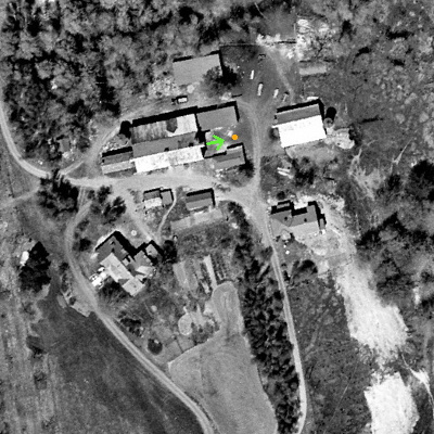
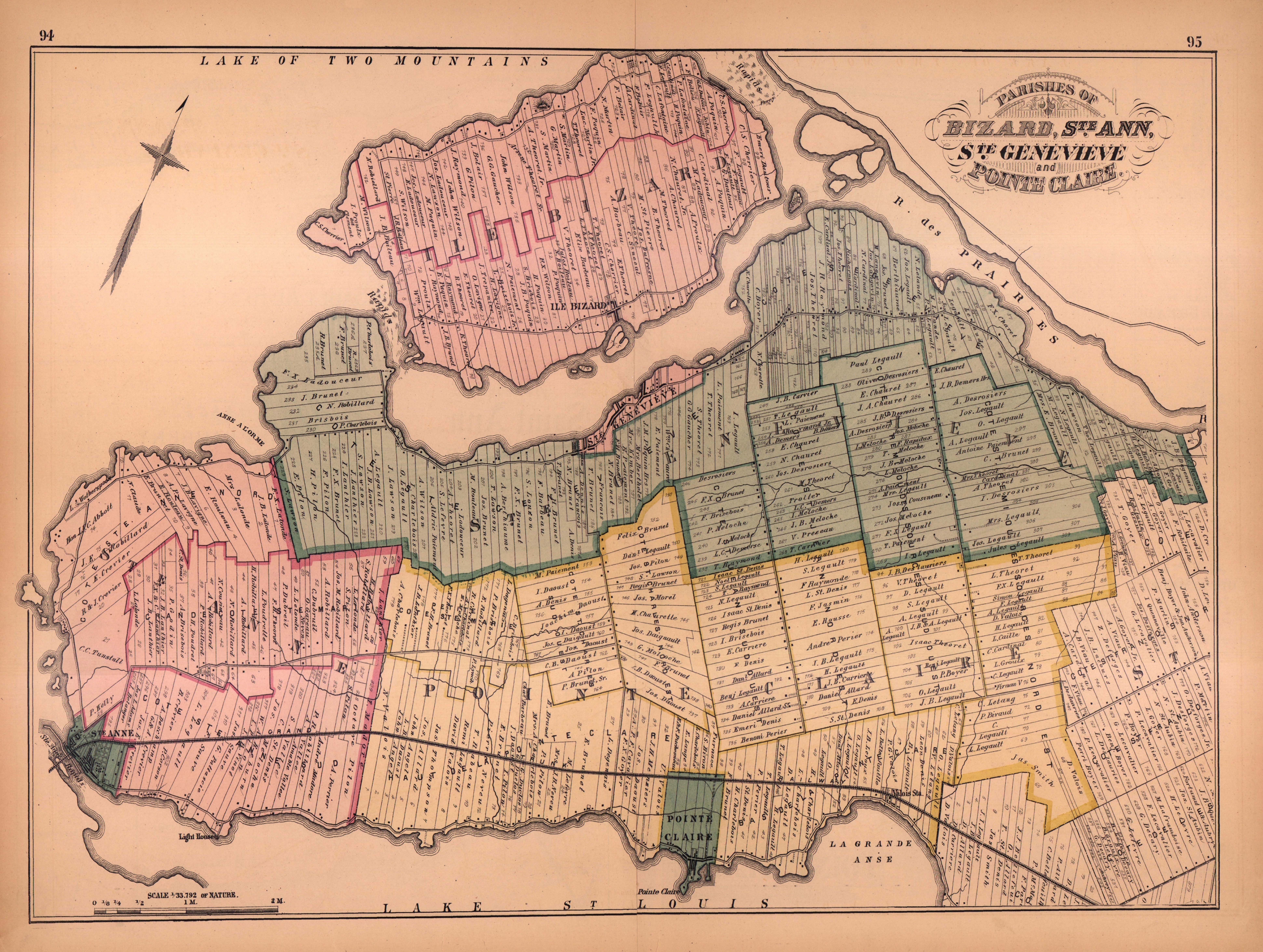